


DETAILED plans to transform the centre of Clydebank have been submitted after years of development.
The way Bankies drive, walk and cycle along Glasgow Road and Dumbarton Road and get to the town hall, library and future developments are all set to change if councillors give the go-ahead.
Sustrans Scotland has committed £2 million to the project, which was widely praised by councillors in 2016 and 2017.
With the formal planning application under way, Provost William Hendrie declined to comment.
But Clydebank Waterfront councillor Gail Casey said she broadly welcomed the plans.
She said: “It’s the future, to make things more accessible for walkers and cyclists. We want to draw people down to the waterfront but don’t want to lose people using the shopping centre.
“It will make for a much nicer environment.”
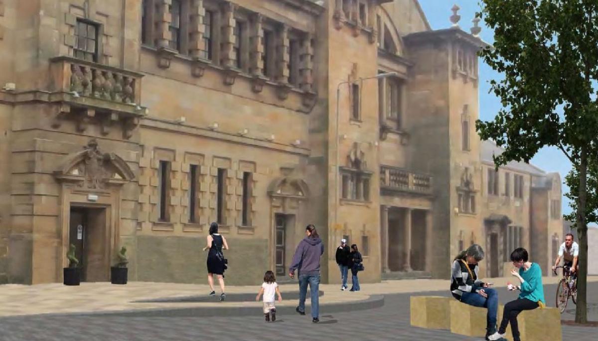
MSP Gil Paterson said: “The artist impressions in the associated documents to this planning application clearly show the merging of the pavement and the road, or ‘shared space’.
“I have concerns about ‘shared space’ in East Dunbartonshire – it has created a lot of controversy among residents. I will be looking carefully at this development to see that lessons are learned. On the whole, I am very much looking forward to the redevelopment of this part of Clydebank – it’s an exciting time for the town.”
The full application stretches from the junction of Glasgow Road with Argyll Road and west to about seven tenements beyond Clydebank Library on Dumbarton Road.
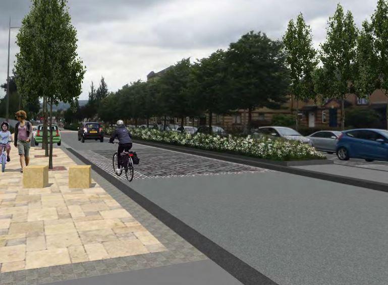
As well as reducing speed limits to 20mph, there will be a shared pedestrian and cycle route, new seating and lighting and improved areas around Solidarity Plaza and the International Asbestos Memorial.
There will also be a pedestrian crossing at the library.
It comes ahead of the upcoming transformation of Queen’s Quay, including work starting later this year on a new care home and health centre behind the town hall.
While the existing light columns on the route will remain, the raised central reservation will go.
Another of the most significant changes include the intersection with Kilbowie Road, making for sharper turns and slowing traffic.
The speed limit change was seen as important to help “change the character of the area and in particular improve safety for on-road cycling”, according to the proposals.
Despite a number of consultation events, there were only 33 comment forms filled out and nine online surveys completed.
Concerns were raised about parking, particularly for those with mobility issues around the town hall, church and library. There will now be extra parking in Hall Street and accommodation for drop-off, weddings or funerals in front of Morison Church.
Work on the changes has been underway since 2016 as it tries to connect the town centre, canal and public transport hubs with Queen’s Quay and the future esplanade being planned along the Clyde.
The full application can be found on the council's planning website and by searching for application DC18/033.


Comments: Our rules
We want our comments to be a lively and valuable part of our community - a place where readers can debate and engage with the most important local issues. The ability to comment on our stories is a privilege, not a right, however, and that privilege may be withdrawn if it is abused or misused.
Please report any comments that break our rules.
Read the rules hereLast Updated:
Report this comment Cancel